Intelligent Machines Close Contractor’s Technology Circle
When Construction Equipment visited Salt Lake Excavating, a site-development/utility-installation contracting company in Draper (near Salt Lake City), Utah, a Fed Ex driver momentarily interrupted to hand a small package to company owner Pete Larkin.
“I’ve been waiting for this,” said Larkin. “It’s my iPhone 8.”
Larkin and sons Cody (manager of operations) and Kevin (CFO) are technology-minded managers who make a focused effort to keep up with developments that can bring greater efficiency into their operation. Telematics for instance.
Most of the company’s nearly 90 major pieces of earthmoving equipment are new enough, says the senior Larkin, to have telematics capability, which is routinely employed to track machine location, hours, idling time, fuel consumption, service reminders, and fault codes—the latter providing the company’s five service technicians a heads-up for investigating potential problems.
“Telematics systems are incredibly powerful, and the only limitation on our ability to monitor machines lies largely with us, not with data collection or data availability,” says Larkin. “I don’t think it’s an exaggeration to say that these systems have opened up a new world of useful information for the excavating industry.”
Integrating survey technology
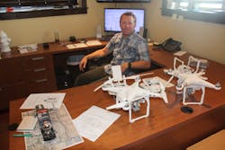
In Cody Larkin’s office (photo at top), a pair of drones sit on the credenza behind his desk, and across the hall, Shane Gee, the company’s resident PE and head estimator, converts drone imaging into topographical maps, which, he says, assist in precisely detailing projects and allow comparing actual site conditions with the developer’s survey.
“Along the way,” says Larkin, “we’ve attempted to keep up with technology, which can be difficult if people we work with don’t willingly embrace it.”
That said, Larkin admits that the company has been slow to adopt grade-control technology.
“We watched the progress of grade-control systems for a number of years,” he says, “but we found it difficult to embrace—basically because we considered it expensive and, honestly, intimidating. We did investigate systems from time to time, but it seemed to us that having to set up blade-mounted hardware every morning was cumbersome and a bit archaic.”
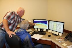
While grade control was on hold, technology was advancing on other company fronts.“For us, the move toward embracing technology started when we got into digital plans,” says Larkin. “For a long time, we were using paper plans and a rolling digitizer to do all our take-offs—measured everything, wrote everything by hand. Then we got a digitizer tablet; that was big time for us—took things to a new level. But we still used paper plans and had to trace everything. The next step was learning to use software that allowed using digital plans from the developer and do take-offs on screen.” At left, Pete Larkin consults with Shane Gee, PE, (right) the company’s head estimator, about the drone imaging technology that the company continues to refine.
What the company’s estimators soon discovered, though, says Larkin, was that the developer’s assessment of existing site conditions was frequently not accurate—whether because the survey was old, or vegetation had skewed the survey, or because material was removed or dumped on the site since the survey. On some jobs, he says, “We were left asking—‘Where did all this dirt come from? It’s twice what we calculated from the engineer’s plan.’”
This situation prompted the company to push its surveying technology forward.
“We decided that the only way we could avoid that discrepancy,” says Cody, “was to do our own topographical survey the instant we got on site. We’ve been developing our use of drones in a survey mode to accomplish that.”
As soon as the company arrives on a new site, it scrubs all vegetation, then launches the drones.
“We place the drone plan right over the developer’s plan,” says the younger Larkin. “If you have hard data, you can negotiate with a developer if need be—but we don’t want a combative environment with developers; they’re using good engineers to develop site plans. The objective is to work with developers to come up with accurate information for bidding purposes.
“A drone flight takes millions of points on the site, compared to maybe several hundred or 1,000 points in a typical physical survey—so there’s a lot of extrapolation between points in a physical survey that isn’t accurate. But if you have millions of points, you have a detailed picture of topography. It’s obvious that this is the future; it will help the developer with both budgets and project feasibility, and it allows the contractor to have more control over bidding—and not get stuck with significant material variations.”
Completing the picture
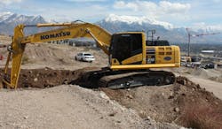
Given the Larkins’ open-minded attitude toward technology, the benefits of using machines with integrated grade-control systems received an intelligent hearing when presented by Chris Faulhaber, business manager, Smart Construction, at Komatsu Equipment Co., the dealer supplying much of Salt Lake Excavating’s equipment. (Watch a Komatsu video about Smart Construction below.)
“It wasn’t until we saw the intelligent Komatsu dozers and excavators with all this technology integrated into the machine, that we figured this was something we could embrace,” says the senior Larkin. “So when we went to the last Conexpo, investigating this technology was first on our list—followed by new software for processing drone information.”
“We realized that the site-survey technology we were developing fit well with the capabilities of these integrated grade-control systems,” says Larkin, “and the staff at the dealership helps us develop 3D design models that we can load into our machines—which can then work with no survey points.”
Salt Lake Excavating would like to develop some degree of 3D-modeling capability in-house, says Larkin, not to replace the work Komatsu Equipment does, but as a backup in situations that require an immediate file update. Komatsu Equipment provides the 3D model on a flash drive, but is working to make that transfer to machines a wireless process.
Given that Salt Lake Excavating is a relative newcomer to integrated grade-control systems, a certain awe factor is still present.
“This is powerful technology,” says Larkin. “This is where the future is going—you have so much control over the excavating process. The dozer operator is seeing an aerial view of the site, with all the site’s features indicated—roads, curb and gutters, utilities—and all the while the machine is calculating how to achieve the model. We also download manhole locations and valve locations into the model, so the operator is cautioned that a utility is close by.”
(The integrated grade-control system in Komatsu “intelligent” dozers is designed to automatically follow the model from first rough cut to finished grade without requiring the operator to continually load off-sets into the system as the machine progress to grade.)
Also on Larkin’s list of benefits from using an integrated grade-control system is the exacting work an excavator can perform when under automated control.
“With a conventional excavator working from grade stakes, which more often than not are quickly knocked out of place,” he says, “it’s not uncommon for the concrete crew to show up at a basement excavation and find that the operator has missed a corner. They can’t place their forms, and by that time, the excavator is long gone. The automated machine solves that problem.”
(Komatsu intelligent excavators present the excavation model to the operator via the monitor, and are designed to prevent excavating beyond established grades by automatically controlling the movement of the boom as the operator controls the stick and bucket.)
And when trenching for pipe installations, says Larkin, the intelligent excavator is invaluable for assisting the operator in establishing precise elevations and slopes, allowing an off-set to accommodate bedding material, which then can be spread to an exacting spec. “Saves time, saves material,” says Larkin.
Although the Larkins had no trouble adjusting to intelligent machines once they decided to adopt the technology, their operators, for the most part, were skeptical.
Larkin can tell humorous stories about the company’s operators’ initial reactions to grade control, such as the experienced dozer operator he teases a bit with the nickname “Chicken Little,” because, says Larkin, “any sort of new technology sends him into a ‘the-sky-is-falling’ panic.
“When he learned his dozer was equipped with an automated system, he was beside himself with apprehension,” says Larkin. “Talk to him now, though, and he’ll tell you he doesn’t want to run anything else. He’s understanding the system and working hard to implement it.
“Another of our operators was struggling a bit at first with the concept of smart excavator, until one day he was working alone and had to cut a utility trench into a hillside with no stakes. He took reference points with the bucket, loaded the information into the system, then followed the line drawing on the screen to dig exactly to grade. Now we can’t get him off the machine—which we’re finding typical once operators get familiar with the technology and realize what it can do for them.”
Larkin has discovered that automated grade control has both tangible benefits, as well as benefits that are less so.
“Once operators understand the technology behind the system and really embrace it, then a couple things happen,” he says. “They become really efficient, and we get more done without having to wait for a surveyor. The other aspect of this that has been interesting to watch is that the technology makes our operators feel more professional. They love what they do—they get a boost by using the technology. It’s pretty powerful stuff all around.”


