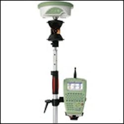
Leica SmartPole
Leica SmartPole enables users to determine coordinates and orientation on-the-fly while conducting the survey, using both GPS and TPS, the company says. The tool is added to System 1200 series. Users find the most convenient location for positioning the total station. Then each TPS set-up can be conducted independently with new coordinates, according to the company, using the SmartPole GPS.
 Leica SmartPole enables users to determine coordinates and orientation on-the-fly while conducting the survey, using both GPS and TPS, the company says. The tool is added to System 1200 series. Users find the most convenient location for positioning the total station. Then each TPS set-up can be conducted independently with new coordinates, according to the company, using the SmartPole GPS.
