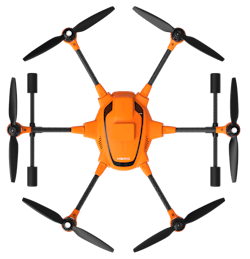
Yuneec H520 Commercial Hexacopter With RTK
The H520 commercial hexacopter will now optionally be available with an RTK (Real Time Kinematic) system from Fixposition.
Even under difficult GPS conditions, such as in cities or canyons, the RTK system is designed to ensure maximum precision and centimeter-precise positioning. The fully integrated RTK satellite navigation enables accurate recurring images, faster 3D mapping, and makes automated inspection flights easier and more precise, the company says.
By using RTK technology, the H520 can now fly much closer to objects for inspection as the UAV positions itself in the centimeter range (1 cm + ppm horizontal/1.5 cm + ppm vertical) rather than in the meter range, which is standard for the unit. This accuracy is paramount for applications where several images need to be taken at the same location on different days, including documenting progress on construction sites.
