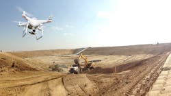
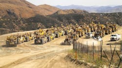
Drone surveying is one of the fastest-growing tools within the construction industry, as it is quicker and more accurate than traditional surveying methods. The goal of this approach is to produce an accurate, high-resolution 3D model of a worksite area. Civil construction sites, quarries, mines, and landfills use this surveying technique to accurately track progress and measure distances, surfaces, elevations, and volumes.
Hadfield is head of product for Propeller Aero
But for many operators, integrating drone imaging into their processes is far from straightforward. They often face challenges such as a steep learning curve, inaccessible software, uncertainty around which drone will work best, and lack of knowledge about flight regulations. These challenges can seem too costly to overcome.
Yet it’s easier to integrate drones on the worksite than one might think. With the right understanding of flight regulations, hardware, and software, any operator can clear a path to drone surveying success and avoid common pitfalls along the way.
Understand certification and flight regulations
All Unmanned Aerial Vehicles (UAVs) are regulated by a country’s aviation authority, and rules around how, when, and if a person can fly a drone differ by country. In the US, before choosing the best drone for takeoff, operators and their teams need to obtain the proper flight certifications and registrations through a simple 3-step process:
- Obtain the FAA Remote Pilot Certificate by passing the ‘Unmanned Aircraft General – Small (UAG)’ test. There are many helpful free practice tests online as well as multiple study guides to use along the way.
- Register the drone with the Federal Aviation Administration (FAA) on the FAADroneZone website
- Follow the two main tenets of drone flight. By law, a drone must be kept below 400 feet in altitude and it must be within an operator’s line of sight. For larger construction sites, the FAA can grant Part 107 waivers to individual surveyors or surveying teams to bypass these requirements.
Navigate restricted airspace
It’s simple to check the latest airspace restrictions in the area surrounding the jobsite with apps like B4UFLY. In the U.S., airspace is divided into multiple classes, some of which are completely restricted to drone flight or have specific altitude limitations. When assessing a new jobsite, use the app to determine which classes of airspace the jobsite occupies and be extra vigilant if it is near an airport, helipad, military base, or urban environment.
If the airspace is controlled, operators must gain additional authorization, usually from the airport (through the LAANC program) or military. This process can be streamlined when using DJI drones with their Fly Safe Portal.
Choose the right hardware
Once an operator obtains the necessary certifications and flight training, the next question is often “What kind of drone should I buy?”
For daily or weekly flights, a professional-level drone built to withstand the wear and tear of a construction site and backed by comprehensive insurance is the best bet. For drone surveying, a high-resolution camera and long battery life for increased flight time is essential to capture a precise survey in one go.
In addition, autonomous flight capability is a must for efficient flight routes and routine surveys. Finally, look for a drone with Real-Time Kinematic (RTK) capability, a method which improves GPS data through constant corrections relative to a fixed ground station. With RTK, a drone can improve its locational accuracy to the centimeter level.
The type of drone is an important consideration, and the best choice will vary depending on the type of terrain being surveyed. Are there bridges, power lines, or mountains that require sophisticated obstacle detection and collision avoidance? Does the drone need to fly in low temperatures or possibly in inclement weather? Do operators need to be able to alternate different payloads (cameras) or have pixel count requirements?
A quadcopter may be the most versatile drone model for construction sites; it often includes a high-resolution camera and interchangeable payload attachment, and is widely available for purchase at a reasonable price. Quadcopters like the DJI Phantom 4 series can handle almost any surveying task and are a good place to start.
There are specialized drones better suited for unique use cases. Examples include fixed-wing drones that can cover larger sites such as a nine-kilometer railway project more quickly and without needing to recharge as often, or vertical takeoff and landing (VTOL) drones like the Wingtra One GenII that can launch from tighter spaces.
Choose the right software
Equally as important as the drone itself is the software an operator uses to piece together the data it gathers, since that output, a set of point clouds, is used to assess site progress, validate cut/fill volumes, or even settle disputes between contractors.
It’s important to choose a program with cloud capabilities to share survey results more readily across remote teams in real time. Using a solution that includes data oversight by geospatial experts can help ensure confidence and trust in the final survey deliverable.
To boost the accuracy of each survey, select software that leverages ground control points, which are physical markers laid onsite to maintain consistent map coordinates. Also, ensure the platform makes data collection easy without disrupting established processes. Data that is easier to import, export, and share in multiple formats makes for tighter collaboration between office and field workers and a clearer shared understanding about exactly what is happening on a job site. With accurate and accessible software, there’s no room for misinterpretation. This means decisions can be made faster, with more confidence, and with less friction.
Although not necessary for all jobs, it is useful to have software that enables surveyors to integrate their own maps and designs into a 3D model that anyone onsite can easily interpret. Ultimately, it will inspire confidence in decision making at all levels.
Maximize drone surveying
Equipped with the right drone and software, mapping out a seamless workflow is the final step to integrating drone surveying at a construction site. The practical process of drone data collection can be completed in a few steps:
- Place ground control points at specific locations onsite.
- Set the flight route with an easy-to-use mission planning app and assemble the drone for launch.
- Take flight and monitor the drone’s journey through a handheld remote.
- Once the drone autonomously returns and lands, collect the ground control points and upload the data to a rapid processing platform for fast turnaround.
From a managerial standpoint, effectively integrating drone technology involves introducing all necessary construction workers to the new tool to help them understand how they can use the 3D model to visualize the site and make smart decisions during their daily activities. Informational and demonstration sessions will give the team an opportunity to become familiar with flying the drone, allowing them to build the skills they’ll need to obtain licenses and certifications. Whether using a single drone or employing an entire fleet, look for a drone visualization platform with robust tech/customer support and infrastructure to ensure team members learn about drone repair and troubleshooting.
It’s also recommended that operators use composite surveying techniques (stitching together multiple smaller surveys), which involves flying over only the areas of a site that have changed, to keep maps up to date with shorter flights. Finally, leveraging an advanced collaboration platform to foster communication will streamline data sharing between key stakeholders.
Take to the skies
As construction projects grow increasingly complex, it is imperative that operators find ways to visualize jobsites more accurately. Drone surveying provides an all-in-one solution, offering more precise models in less time.
Operators who choose a drone with good functionality, feed the data into a flexible and accurate platform, and get the team on board, will see their site come to life in digital form, and watch their drone program take off.


